You might wonder what makes a trail challenging. For us, it depends on a few things, but the main one is how tired we feel after finishing. Of course, exhaustion is different for everyone — and since we’ve done a lot of hiking, most trails don’t wear us out. For example, we once hiked all the trails at Mount Jefferson State Natural Area in a single day (read more about that adventure here). Even with all the elevation changes, we still felt fine afterwards.
But when we hiked the Riverbend Backcountry Trail at New River State Park, we were definitely worn out by the end. At 3.5 miles one-way from its official trailhead — plus roughly another mile each way just to reach it from the parking area — the round-trip can easily run nine miles in total. While it isn’t as technically tough as the Grandfather Trail, it’s still demanding. So, is the Riverbend Backcountry Trail one of the most challenging in North Carolina? We think it’s worth considering — and below, we share our experience hiking the trail.
The trail starts at the Wagoner Access of New River State Park, located in Ashe County about 8 miles southeast of Jefferson.
Before we dive in, we’ve also compiled some additional resources about New River State Park that you might find useful. Happy adventuring!
Additional Resources
- The Ultimate Guide to Every Hiking Trail at New River State Park
- Whispers of the Past: Finding Historic Homesteads Along the New River
- Where the Water Is: The Best River-View Trails at New River State Park
Table of Contents
- Dude, where's the trailhead? Wagoner Access Map and Reaching the Riverbend Backcountry Trailhead
- The Ascent: Riverbend and Peaks Areas Map and Start of the Riverbend Backcountry Trail
- Out on the Ridge: Walk-In Campsites
- The Descent
- The Pine Forest Wonderland
- The Barn
- Drumroll Please: The New River
- Final Thoughts
Dude, where’s the trailhead? Wagoner Access Map and Reaching the Riverbend Backcountry Trailhead
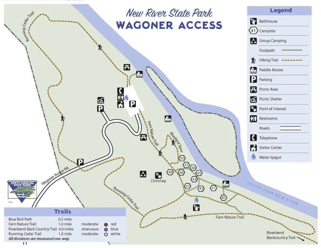
We began our hike at the Wagoner Access in New River State Park. We parked in the upper lot — farthest from the river, and where the Running Cedar Trail crosses Wagoner Access Road. If you look at the map, the Riverbend Backcountry Trail starts in the far right corner, so you’ll need to hike along other Wagoner Access trails to reach the trailhead.
Since we parked in the upper lot, we started on the Running Cedar Trail, then connected to the Fern Nature Trail, and finally reached the Riverbend Backcountry Trail. No matter which route you take, expect to hike about a mile just to get to the Riverbend Backcountry trailhead itself.
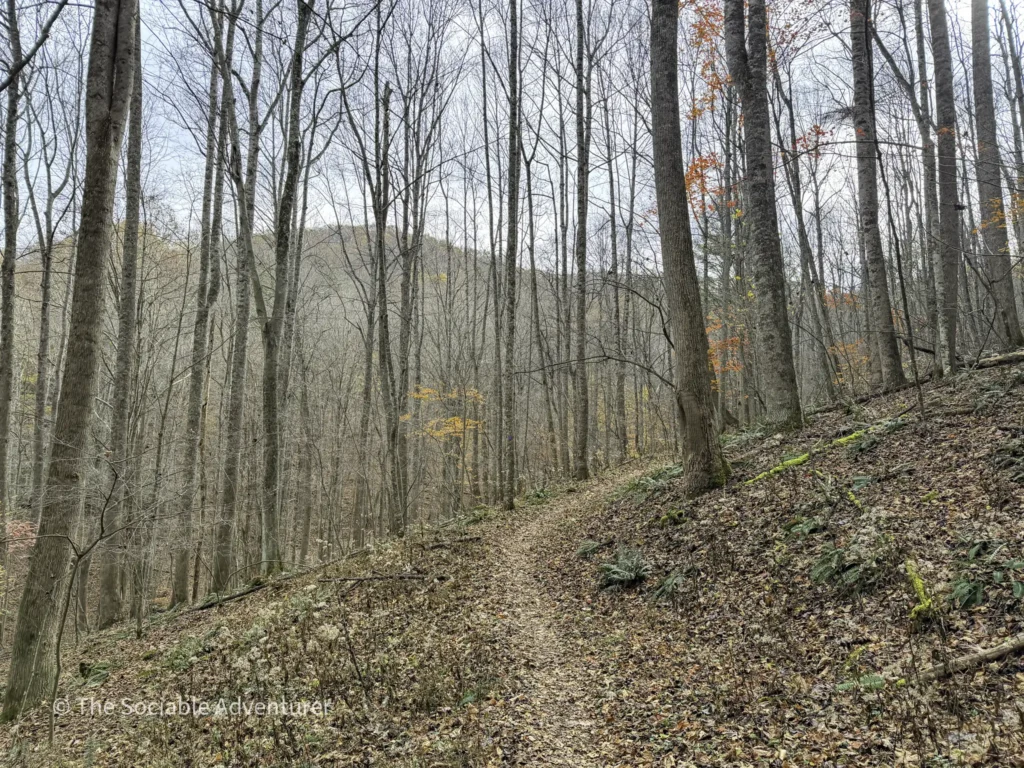
The Ascent: Riverbend and Peaks Areas Map and Start of the Riverbend Backcountry Trail
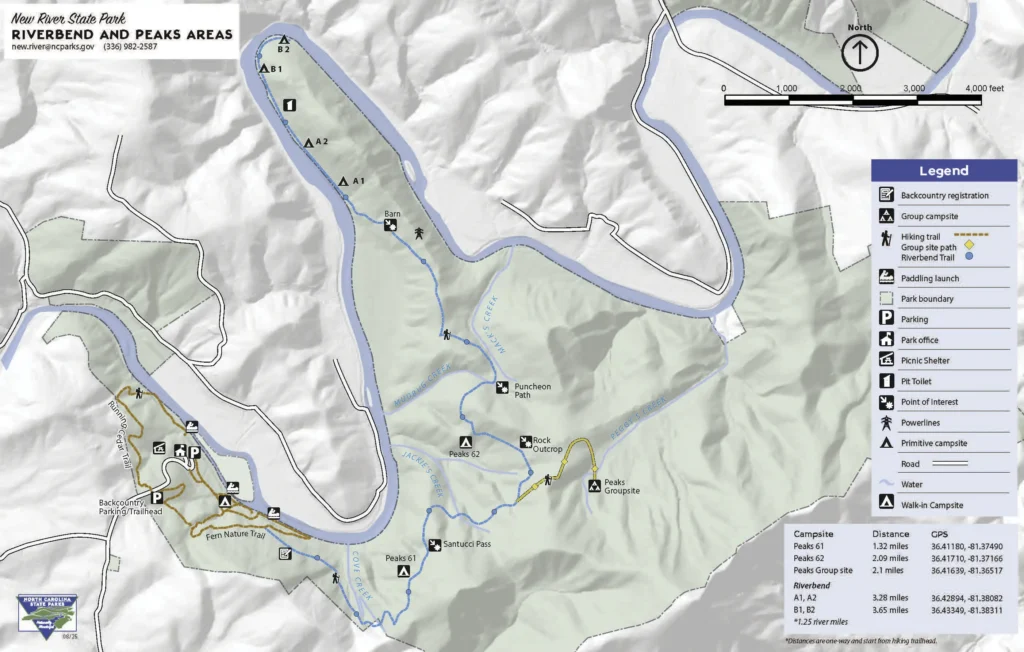
The Riverbend and Peaks area map is the next key resource for your trip. It gives more details about the trail and its surroundings. At the start, you’ll see distant views of the New River and the Blue Ridge Mountains as the trail begins to climb right away. There’s also a backcountry registration spot at the beginning of the trail, similar to what you’ll see at some of the Grandfather Mountain trails — be sure to sign in before continuing.
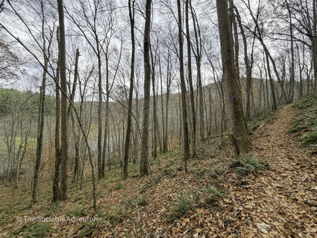
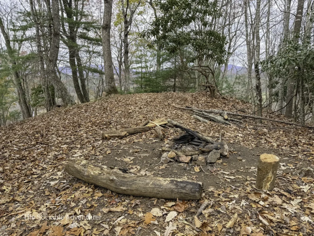
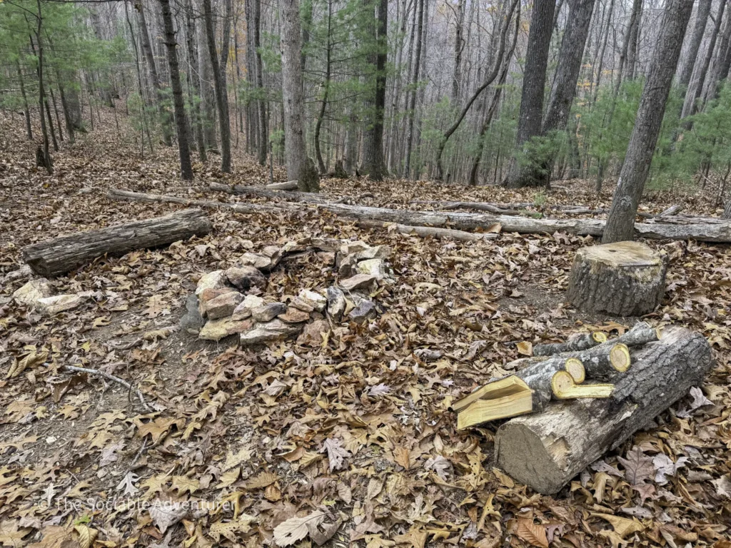
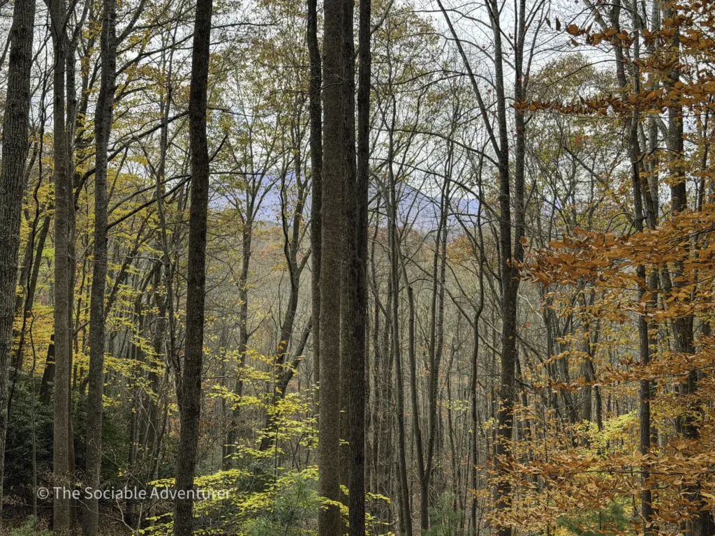
Out on the Ridge: Walk-In Campsites
As you reach the ridge on the trail, you’ll come across several walk-in campsites that offer amazing views of the landscape below — including the New River. The scenery is especially nice in winter, when the trees are bare, and the views open up. There’s also a side trail to the left of the Riverbend Backcountry Trail that leads to a group campsite. Remember, these are walk-in sites, so you’ll need to carry your camping gear in, as there’s no parking nearby. Reservations are required through the North Carolina State Parks system.
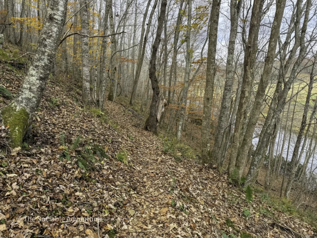
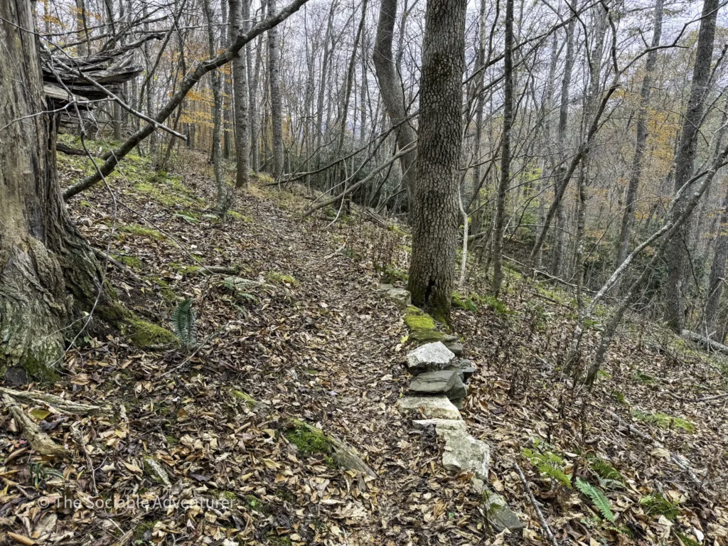
The Descent
Once you leave the ridge, the trail begins to go downhill. The slope isn’t very steep, but it’s still a good idea to move carefully and watch your step — especially if it has rained or snowed recently. The descent gives you a real sense of the trail’s variety: ridge-top forest gives way to a quieter, more enclosed stretch of woods as you head toward the river below.
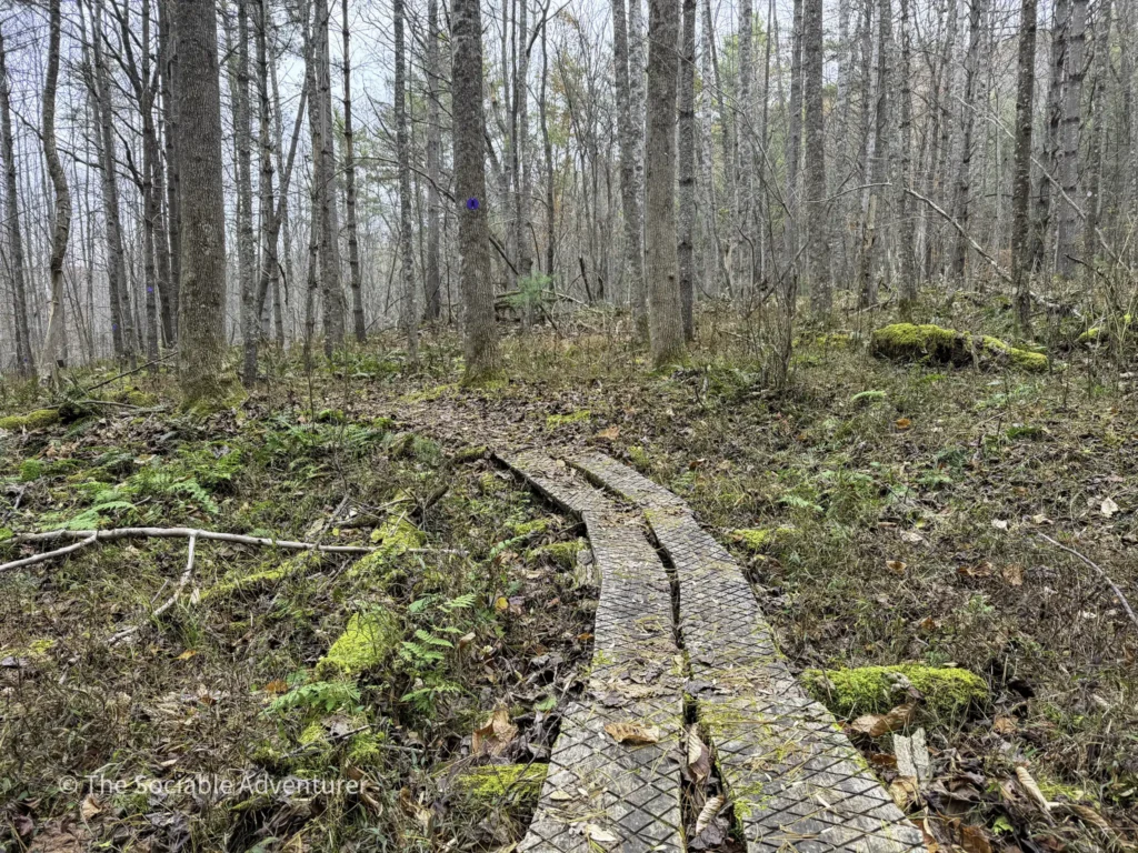
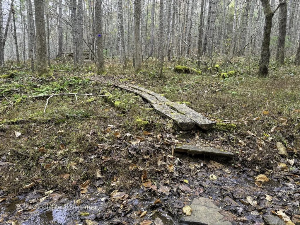
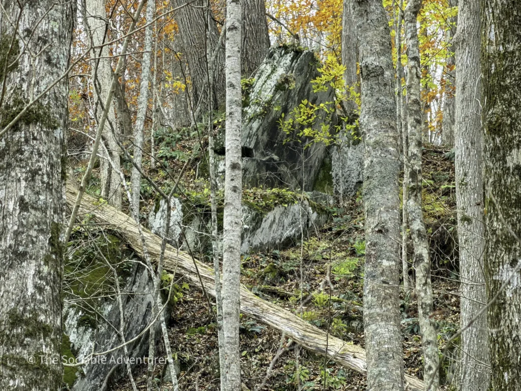
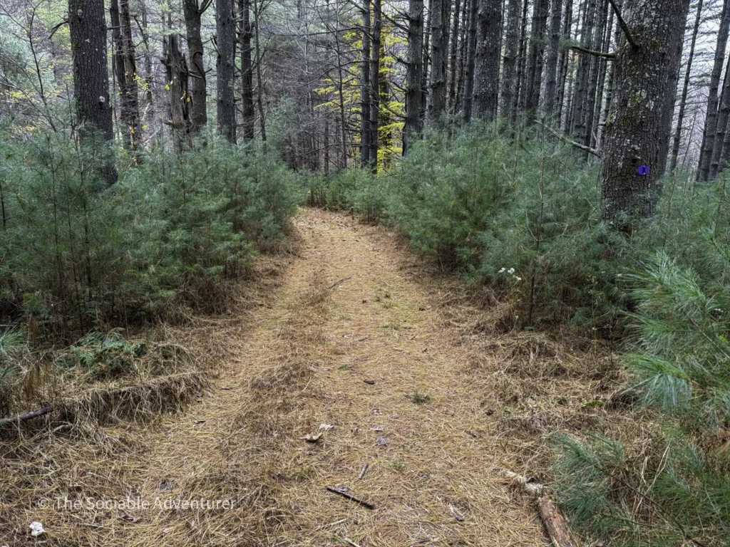
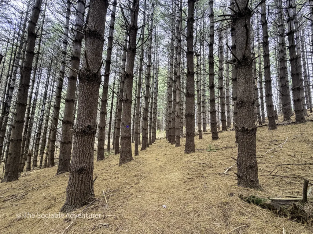
The Pine Forest Wonderland
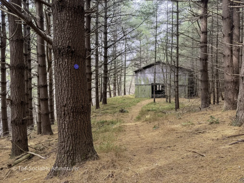
Pine forests are always a favorite. At New River State Park, it looks like there was a major reforestation project in the past, and the Riverbend Backcountry Trail runs right through the heart of it — long, straight rows of pine that give the trail an almost cathedral-like feel. We want to warn you that the trail can be a bit difficult to follow through the pine forest, so make sure to always look for the blue blazes before proceeding.

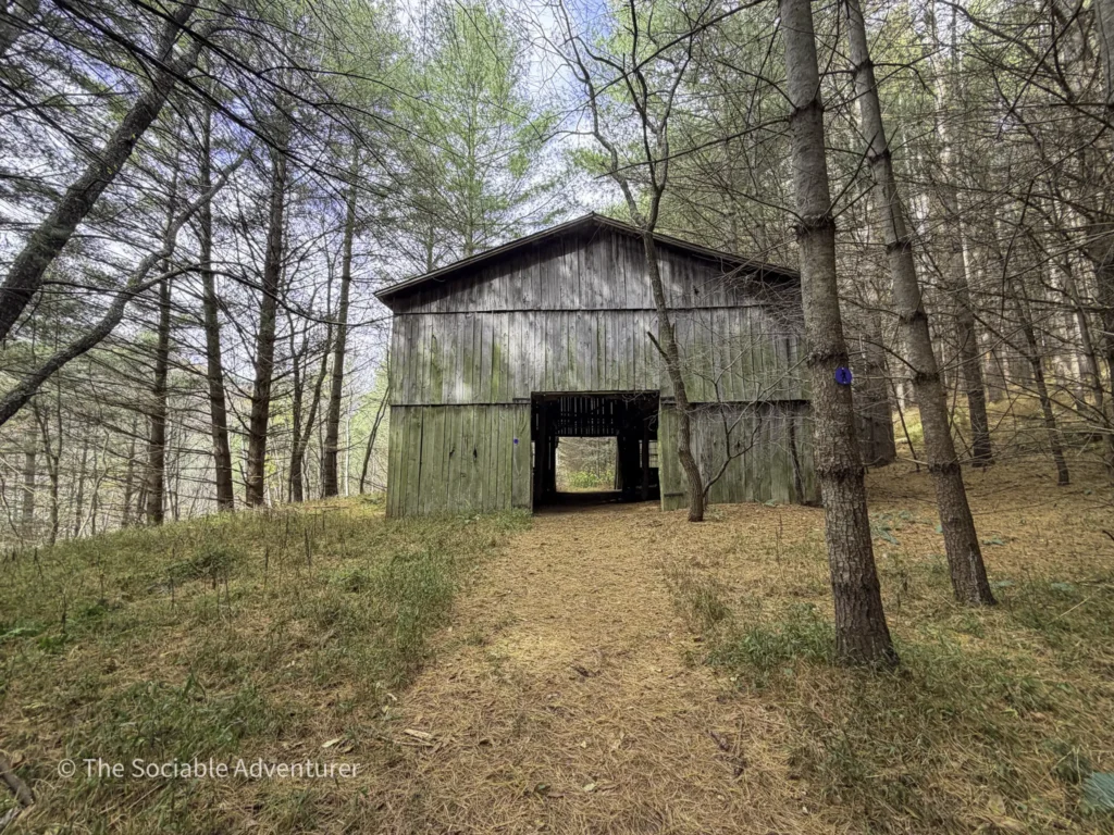
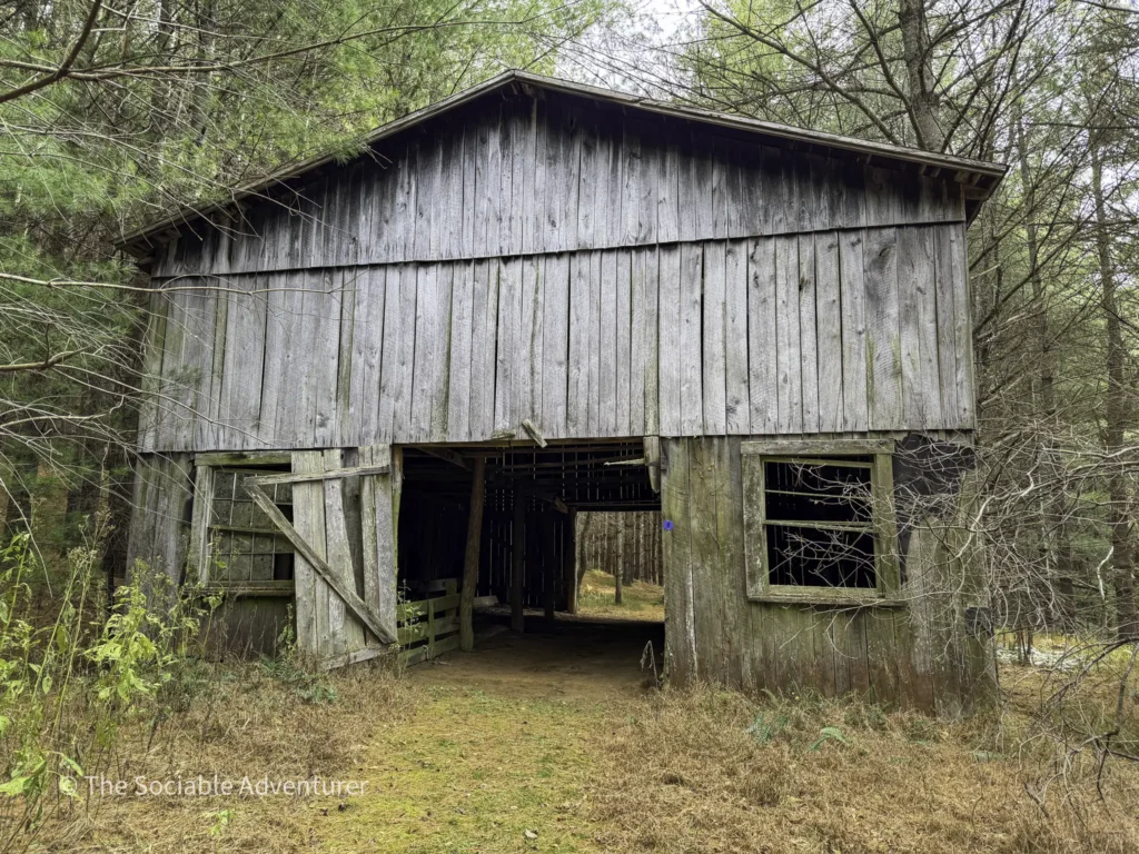
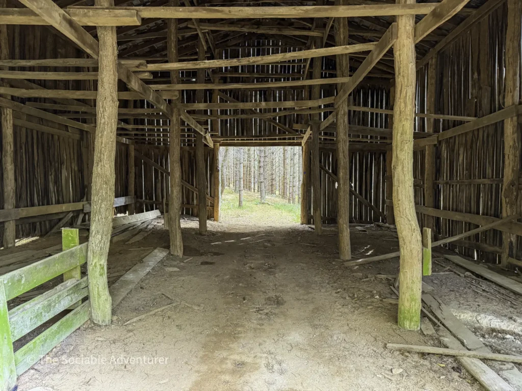
The Barn
We really enjoy finding old structures, and the barn on this trail is one of the most interesting you’ll see anywhere in the park. The path actually goes right through the middle of it — a striking, weathered piece of the New River corridor’s farming past that has somehow stayed standing long enough for the trail to take advantage of it. For more on this barn and the other historic structures we’ve found while hiking at New River State Park, see Whispers of the Past: Finding Historic Homesteads Along the New River.
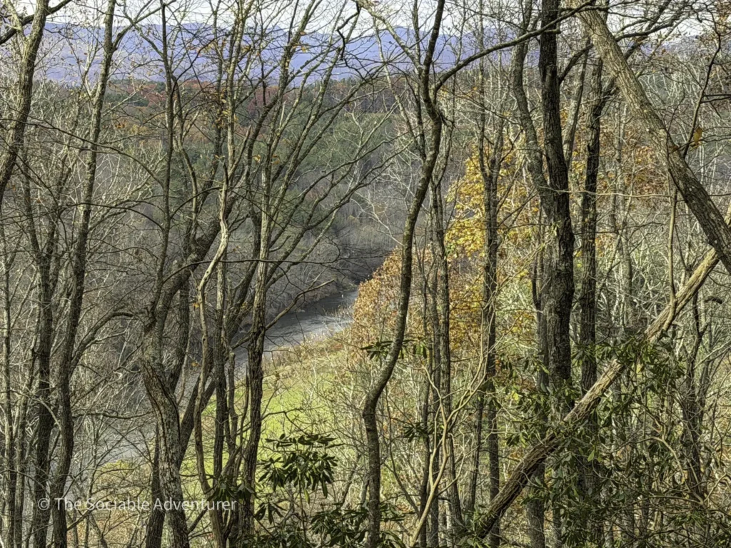
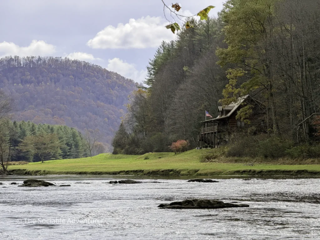
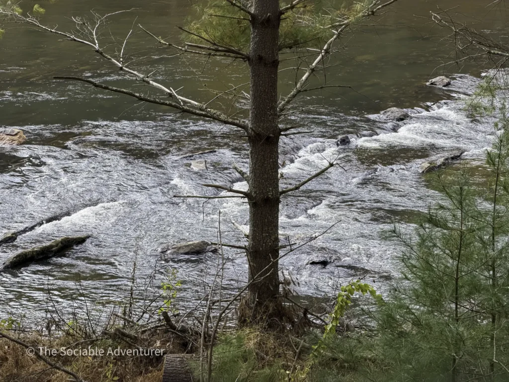
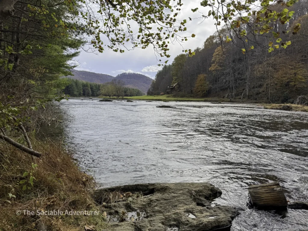
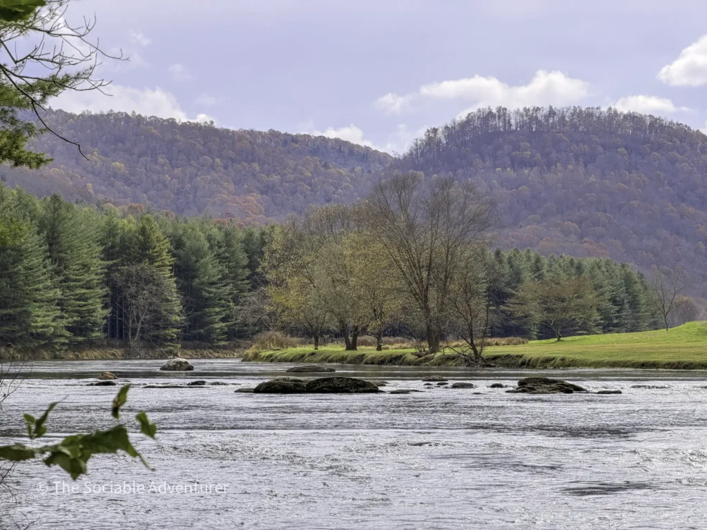
Drumroll Please: The New River
As you get closer to the end of the trail, the New River comes back into view in a beautiful way. We have a whole post about the best New River State Park trails for river views, and now that you’re here, you’ll see one of our favorites — especially in the fall, when the surrounding trees light up with color. If you want to stay overnight, there are more primitive campsites near the river, with reservations required through the North Carolina State Parks system. And remember to pack out what you pack in — there are no toilet facilities at these sites, so visitors are required to dig at least an 8-inch cat hole for waste disposal.
Give yourself some credit for making it this far!
Final Thoughts
Remember, this is an out-and-back trail, so you’ll retrace your steps on the way back — adding the full 3.5 miles to your day, plus the mile or so back through the Running Cedar and Fern Nature Trails to your car. By the end, you’re looking at roughly nine miles of hiking. Make sure to pack plenty of water, sturdy footwear with good grip, layers for the changing weather, and a few snacks. Give yourself plenty of daylight too — between the climb, the pine forest, the barn, and the river finale, you’ll want time to enjoy each stretch rather than rushing through.
Thanks for coming along with us. We hope you feel inspired for your next adventure — and if you’re planning a fuller visit to New River State Park, take a look at our Ultimate Guide to Every Hiking Trail at New River State Park for everything else worth knowing.

Your Complete Guide to Hiking Trails at Elk Knob State Park
Elk Knob State Park is one of North Carolina’s most rewarding mountain destinations — a 4,400-…

A Complete Guide to the Trails at Carolina Beach State Park
Tucked along the Cape Fear River on Pleasure Island, Carolina Beach State Park is one of southeaster…

The Complete Guide to Hiking Trails in Lansing, NC
Set in the rolling hills of Ashe County, just a stone’s throw from the Virginia and Tennessee …

Exploring Ashe County Park: A Hiker’s Guide to North Carolina’s Mountain Gem
If you’re searching for the best hiking trails at Ashe County Park in North Carolina, you̵…

Mountain Masterpieces: A Guide to the Ben Long Frescoes of Ashe County
In the quiet corners of Ashe County, where the Blue Ridge Mountains meet peaceful valleys, thereR…
Granite, Grunts, and Glory: A Day on the Stone Mountain Loop Trail
The Stone Mountain Loop Trail is the signature hike at Stone Mountain State Park in North Carolina —…